Thinking about trading city sidewalks for moss-draped oaks and tidal creeks? If you’re eyeing Johns Island as a new home base, you’re balancing natural beauty and space with a more car-dependent lifestyle. In this guide, you’ll get a clear, local look at pricing, property types, commute realities, and how Johns Island compares with Daniel Island, Mount Pleasant, and Downtown. You’ll also get a practical checklist to make a confident decision. Let’s dive in.
Johns Island at a glance
Johns Island sits southwest of the Charleston Peninsula, framed by the Stono and Kiawah rivers. The landscape blends marsh, tidal creeks, and upland ridges, which shape where homes can be built and the types of lots you’ll find. If you’re seeking a stronger connection to Lowcountry nature, this setting delivers. You can learn more about the island’s geography from the Johns Island overview.
Access relies on a few main corridors, especially Maybank Highway and River Road/Main Road. With growth, those roads can back up at peak times. Local updates point to multi-year projects aimed at easing bottlenecks, but timing is phased and subject to change. Expect commute times to vary more than on Daniel Island or parts of Mount Pleasant, and track road work via local road updates.
What you can buy on Johns Island
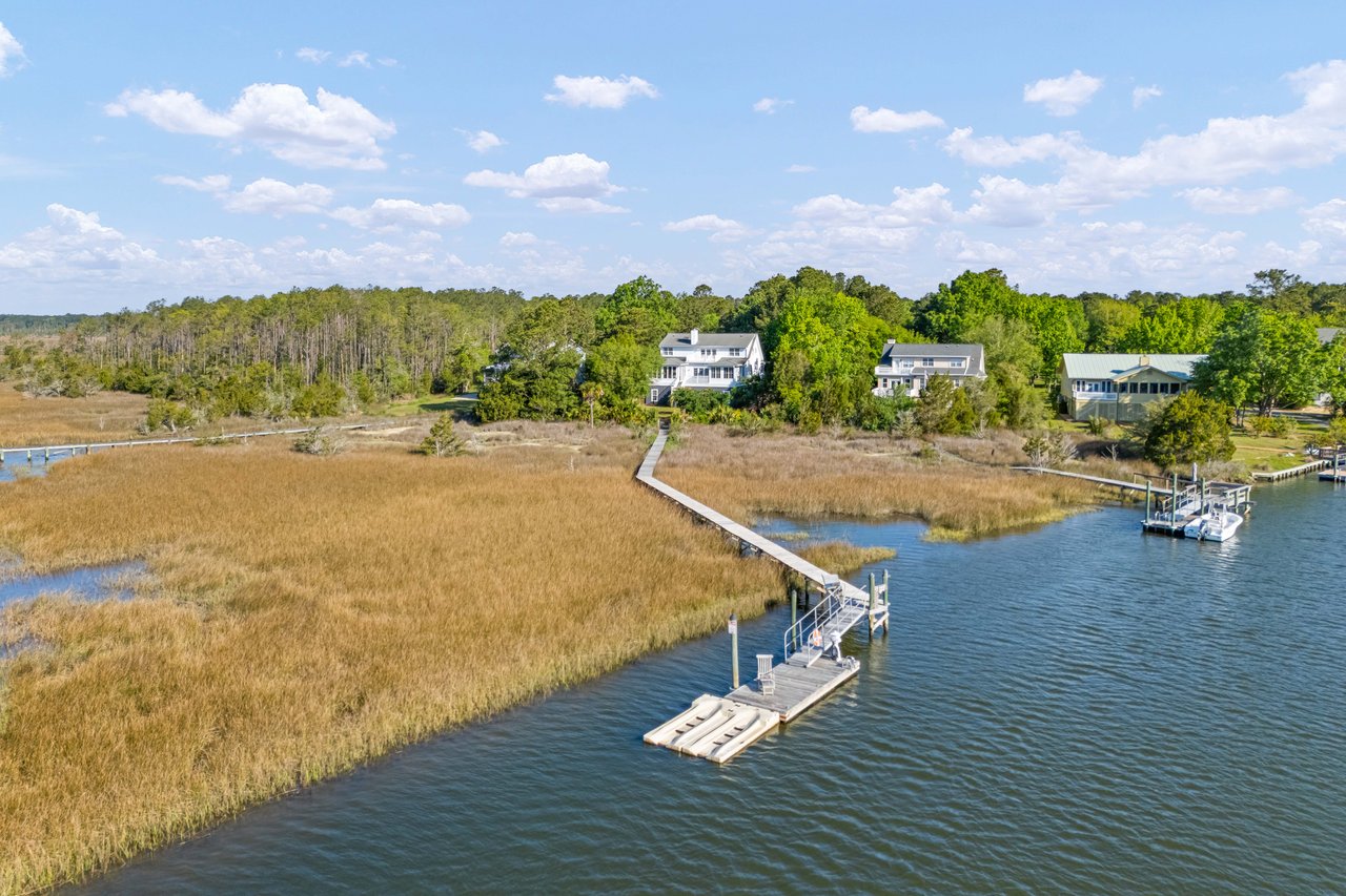
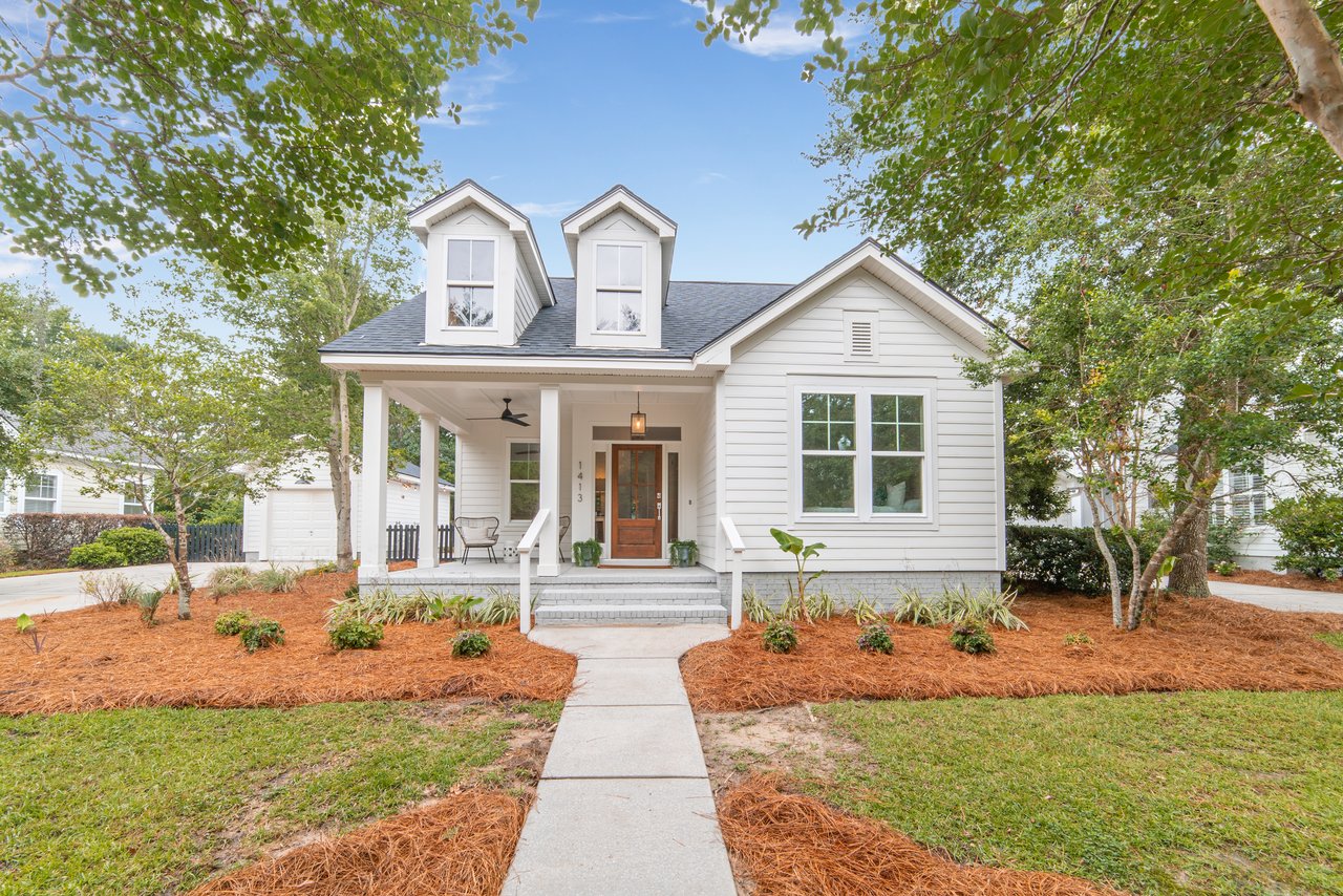
If you want options, you’ll find them here. Johns Island ranges from compact townhomes and small infill lots near main corridors to quarter- and half-acre parcels in traditional subdivisions. You’ll also see multi-acre estates, working-ag land, and deepwater homes with private docks on the Stono River, Bohicket Creek, and other tidal waterways.
Pricing is wide-ranging. A recent market snapshot placed the Johns Island median single-family sale price in the mid-six-figure range, around 650 to 660 thousand dollars (Redfin, Jan 2026). Neighborhood medians vary sharply, so use current MLS data for any specific address and property type.
Lot sizes and water access
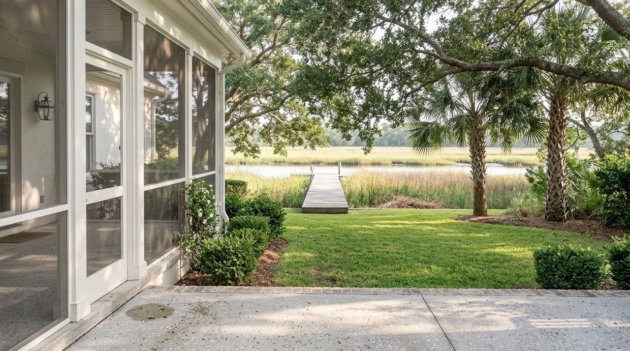
If you value space, Johns Island stands out. Larger interior parcels and private, wooded settings are common. Deepwater properties command a premium due to boat access and views, and they often involve dock permitting and shoreline considerations. For parcel-by-parcel acreage and boundaries, use the Charleston County parcel viewer. Because many homes are near marsh or tidal creeks, confirm flood zones early through the FEMA Flood Map Service Center to understand elevation and insurance implications.
Master-planned pockets to know
Beyond rural stretches, Johns Island has master-planned neighborhoods with amenities and design standards. Communities like Kiawah River illustrate the scale of newer, planned development with trails and community features woven in. Explore the Kiawah River community overview and supporting county planned-development documents such as the Kiawah River PD/Development Agreement for a sense of planned density and infrastructure expectations.
Everyday life and tradeoffs
Walkability and retail
Johns Island has growing retail and grocery options, but they are spread out compared with more centralized areas. Most residents drive for everyday errands. Many buyers accept that tradeoff in exchange for larger lots, privacy, and potential water access. If you want most errands on foot, Daniel Island or the Charleston Peninsula may fit better.
Commute reality and roads
Because access is concentrated on a few corridors, travel times can swing with traffic and construction. Morning and evening peaks are the pinch points, and delays can be significant during incidents. Multi-phase projects to improve Maybank Highway and the Main Road corridor are in progress, but schedules evolve. Stay current using local road updates and drive your route at the times you expect to commute.
Schools and services
Charleston County School District serves Johns Island with on-island public schools and nearby options. Boundaries and assignments can change as growth continues, so verify by address through the CCSD schools by constituent district page. For independent schools, commute patterns, rather than distance alone, will guide your decision.
Utilities: sewer and septic
Sewer service on Johns Island is not universal. Many newer neighborhoods and areas within the City or urban growth boundary have sewer, while rural parcels may rely on private septic or community systems. Confirm service through the Charleston Water System service-area map and request a service-availability letter during due diligence.
How Johns Island compares nearby
- Daniel Island: A newer, intentionally master-planned island with integrated trails, schools, and a town center that supports daily walkability. Median prices trend into the low-to-mid seven figures (Redfin, recent months). Highway access via I-526 generally produces more predictable commutes than Johns Island.
- Mount Pleasant: A built-out suburban market with a wide range of neighborhoods, strong retail access, and multiple route options. Home values are often higher than comparable Johns Island properties in many segments (Zillow’s home value index across subareas).
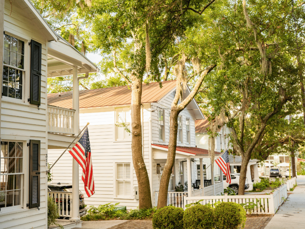
- Downtown Charleston (the Peninsula): The most walkable and urban environment with the region’s highest per-square-foot pricing and very limited lot sizes (Realtor.com). Here, you trade space and private docks for historic architecture, restaurants, and cultural amenities.
Is Johns Island a fit for you?
Johns Island may be a great match if you want space, privacy, and a stronger connection to the Lowcountry landscape. Buyers who prioritize deepwater access, room for outdoor living, or multi-acre parcels often feel at home here. If you do not mind driving for weekly errands and can tolerate some commute variability, the lifestyle rewards can be significant.
If you prefer short walkable commutes, a town-center lifestyle, or the shortest rush-hour trips to Downtown, consider Daniel Island, parts of Mount Pleasant, or neighborhoods on the Peninsula. Those areas typically offer tighter proximity to daily services, but with different tradeoffs on lot size and price per square foot.
A smart due diligence checklist
Use this list to move from browsing to clarity:
- Confirm the exact FEMA flood zone and base flood elevation for the property through the FEMA Flood Map Service Center.
- Verify sewer and water availability, or whether the home relies on septic, via the Charleston Water System service-area map. Ask for a current service letter.
- Check parcel acreage, boundaries, and recent surveys using the Charleston County parcel viewer.
- Review HOA covenants, permitted dock/shoreline work, and any wetland or Army Corps constraints. County planned-development documents, such as the Kiawah River PD/Development Agreement, illustrate how rules are structured.
- Confirm school assignment by property address on the CCSD schools by constituent district page.
- Get quotes for wind and flood insurance early. The City of Charleston’s Flood Information FAQs outline basics that affect costs and construction.
- Test your commute at your actual days and times. Road geometry magnifies peak-hour congestion, and conditions evolve with ongoing road projects and updates.
Final thoughts
Johns Island offers a rare mix: spacious lots, centuries-old oaks, and the chance to live on or near deepwater, all within reach of Charleston. The tradeoffs are real, especially around commuting and car-dependent errands, but for many buyers the lifestyle is worth it. If you want room to spread out and a stronger daily connection to the marsh and river, Johns Island deserves a close look.
Ready to compare neighborhoods, dial in commute options, and tour on- and off-market opportunities? Connect with Tricia Peterson for a private, concierge-style consultation. Find Your Island — Schedule a Private Consultation.
FAQs
What are typical home prices on Johns Island in 2026?
- Recent snapshots show a median single-family sale price in the mid-six-figure range, around 650 to 660 thousand dollars (Redfin, Jan 2026), with wide variation by neighborhood and property type.
How long is the commute from Johns Island to Downtown Charleston?
- Commute times vary due to congestion on Maybank Highway and River Road/Main Road; peak-hour delays are common and can be severe during incidents, so test your route at your actual times and follow local road updates.
Do Johns Island homes require flood insurance?
- Many properties are near tidal areas and fall within FEMA Special Flood Hazard Areas, which typically triggers lender-required flood insurance; check any address on the FEMA Flood Map Service Center and get quotes early.
Is sewer available on Johns Island, or will I need septic?
- Sewer service is available in parts of the island, especially within the City/urban growth boundary, but many rural parcels use septic; verify by address using Charleston Water System’s service-area map and a current service letter.
What types of properties are common on Johns Island?
- You’ll find townhomes and small infill lots near corridors, quarter- to half-acre homesites in subdivisions, multi-acre interior parcels, and premium deepwater properties with private dock potential on rivers and tidal creeks.