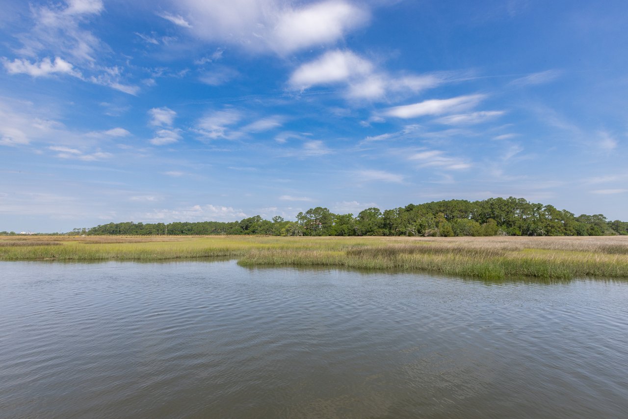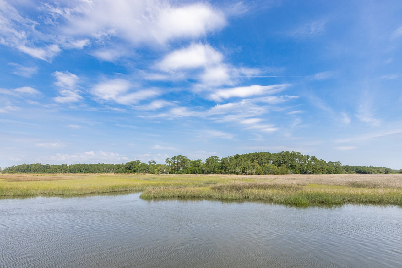
Salt marsh views in Mount Pleasant can feel like magic. Wide skies, shifting tides and golden grass make every evening a show. Yet building or buying on the marsh is not the same as an inland lot. You face different rules, extra permits and design choices that affect long‑term value. This guide walks you through what to check, who to hire and how to compare lots with confidence. Let’s dive in.
Why marshfront lots are different
Marshfront parcels along the Wando River, Shem Creek and the Intracoastal sit in a dynamic environment. Tides, salt spray and regulated wetlands shape what you can build and where. These factors influence dock rights, setbacks, elevation, insurance and maintenance.
Primary risks include tidal flooding, storm surge, erosion and salt corrosion. Sea level rise and marsh migration can also change views and shorelines over time. You can manage these risks with early due diligence and the right team.
Start with maps and rules
Flood zones and elevation
Begin by pulling the FEMA Flood Insurance Rate Map (FIRM) panel for the parcel so you know the flood zone and Base Flood Elevation. If the lot is in a Special Flood Hazard Area, plan on elevation requirements and higher insurance. Order or confirm an Elevation Certificate, then compare a current topographic survey to the BFE for true site conditions.
Zoning, setbacks and buffers
Confirm the Town of Mount Pleasant zoning district for the lot. Town rules set building height, setbacks and buffers from tidal marshes or wetlands. Overlay districts and HOA design guidelines may further limit height, materials, colors and docks. Ask about tree protection rules since large trees can shape the buildable envelope.
Wetlands and the critical line
Hire a qualified wetland delineator to locate jurisdictional wetlands and the local marsh critical line. This line and any required buffers often control where structures can go. Do not rely on rough estimates. Get a stamped survey and site plan that shows these limits.
Docks, piers and shoreline permits
Private docks or lifts generally require approvals from South Carolina DHEC OCRM, the U.S. Army Corps of Engineers and the Town of Mount Pleasant. In some cases, docks over state‑owned submerged lands also need a lease or written authorization. Verify riparian rights, and review any shared‑dock agreements before you buy.
Shoreline stabilization and living shorelines
Bulkheads, seawalls and living shoreline solutions are regulated. Many projects favor living shorelines where feasible to protect habitat and reduce erosion. If the bank shows active erosion, expect engineered design and more permitting steps.
Utilities, septic vs sewer and drainage
Confirm water and sewer availability with the Town and Charleston Water System. Some outlying parcels may require septic or grinder pumps. Ask about stormwater plan requirements since new builds may need dedicated on‑site retention.
Walk the lot with a checklist
View corridor and tides
Identify the primary view: open water, tidal creek or marsh plain. Visit at both low and high tide to see how the scene changes. Marsh grasses grow and fade seasonally and can affect near‑house views. Ask about view easements or HOA rules that may help preserve sight lines.
Footprint and sun orientation
After setbacks, buffers and tree protections, locate the true buildable envelope. Consider home rotation within the envelope to capture desired views and sunsets. Factor in prevailing winds for outdoor living areas and salt spray exposure.
Boat access and channel depth
If boating is a goal, check nearshore depths at mean high water and compare to your boat’s draft. Dredging and maintenance dredging need permits and may be restricted. For kayaks or paddleboards, look for a gentle slope or a community launch.
Erosion and marsh health
Walk the edge and note signs of undercutting banks, tree loss or marsh dieback. Look for wrack lines, sediment deposition and invasive plants. Ongoing erosion points to future stabilization needs.
Noise, traffic and nearby activity
Observe boat traffic and proximity to marinas or commercial activity, especially near Shem Creek. Wakes and noise can influence dock design and day‑to‑day enjoyment.
Build for coastal conditions
Foundations and elevation
Most marshfront homes use elevated foundations on driven piles or drilled shafts designed from geotechnical borings. Work with your engineer to meet or exceed BFE and any freeboard requirements. Avoid unpermitted fill that could impact wetlands or drainage.
Materials that last in salt air
Use corrosion‑resistant metals, such as 316 stainless steel fasteners or hot‑dipped galvanized hardware, and protect structural steel with the right coatings. Choose durable cladding like fiber cement and consider metal roofing with high wind ratings. Place HVAC and mechanicals above the design flood level and schedule more frequent service.
Dock and shoreline design
Select dock materials rated for marine exposure, such as composite decking and marine‑grade timber or aluminum framing. Boat lifts require structural review, electrical planning and permits. Where suitable, explore living shoreline solutions that protect edges while supporting marsh function.
Landscape and exterior care
Plant salt‑tolerant native species to reduce maintenance and erosion. Keep plantings out of protected buffers. Expect more frequent exterior maintenance such as painting, pressure washing and deck care than you would inland.
Budget, insurance and timeline
Permitting and sequencing
Your sequence often looks like this: confirm zoning and pull FEMA data, then order topography, wetland delineation and geotechnical borings. After surveys, submit a preliminary site plan to the Town while you coordinate with DHEC OCRM and the Corps for any dock or shoreline plans. Dock and shoreline approvals can take weeks to months, and a full path from lot purchase to building permit can extend past one year for complex sites.
Financing, insurance and documentation
Lenders may require flood coverage and an Elevation Certificate. Compare NFIP and private flood options and note the community’s FEMA CRS score for potential premium impacts. Keep records of all permits, shoreline work and dock maintenance for future resale.
The right local team
Who to hire
- Coastal land surveyor for topography, mean high water and critical line mapping
- Wetland delineator or environmental consultant
- Geotechnical engineer for borings and foundation design
- Coastal engineer or marine contractor for docks and shoreline protection
- Architect and builder experienced with Mount Pleasant coastal codes
- Real estate attorney to review riparian rights, easements and leases as needed
- Insurance agent who specializes in coastal risk
Documents to collect early
- Plat, legal description and any easements or HOA covenants
- FEMA FIRM panel and Elevation Certificate
- Town zoning and setback tables for the parcel
- Existing surveys, wetland delineations and any prior permits
- Utility availability letters and estimated connection costs
- Records of previous shoreline work or dredging
Quick decision checklist
- Confirm zoning, setbacks and buffers to establish the buildable envelope.
- Pull the FEMA FIRM and obtain an Elevation Certificate.
- Order a topographic survey, wetland delineation and geotechnical borings pre‑closing if possible.
- Verify riparian and dock rights and whether a submerged‑land lease applies.
- Confirm utility availability and costs for water, sewer and power.
- Evaluate view corridors at low and high tide and across seasons.
- Get initial dock feasibility from a local marine contractor.
- Request prior permits and maintenance records from the seller.
Ready to compare lots with confidence?
You deserve a marshfront home that looks stunning and works for decades. With careful due diligence and coastal‑smart design, you can secure the view, the elevation and the permits that protect your investment. If you want a trusted local partner to coordinate surveys, permits and builder introductions, connect with our boutique team. Start a private conversation with Tricia Peterson today.
FAQs
What permits do I need for a private dock in Mount Pleasant?
- Most docks require approvals from SC DHEC OCRM, the U.S. Army Corps of Engineers and the Town of Mount Pleasant, and some sites also need a state submerged‑land lease.
How do FEMA flood zones affect a marshfront build in Mount Pleasant?
- Your flood zone and Base Flood Elevation drive how high you must elevate the home and influence flood insurance pricing and lender requirements.
Who determines the marsh critical line on a Mount Pleasant lot?
- A qualified wetland delineator maps jurisdictional wetlands and the critical line, then a surveyor stamps a site plan that shows build limits and buffers.
What foundation type works best near the marsh in Mount Pleasant?
- Elevated homes on engineered piles or drilled shafts are common, sized from geotechnical borings to handle local soils, scour and flood loads.
How long do marshfront permits and approvals usually take?
- Expect weeks to months for dock and shoreline permits, with total timelines from lot purchase to building permit ranging from several months to over a year.
Can I stabilize my shoreline with a living shoreline in Mount Pleasant?
- Often yes, where site conditions allow, but design and installation require permits and a coastal professional to evaluate feasibility and method.